A platform designed to facilitate rigorous spatial analysis and modelling.
Complete drawing environment with survey utilities.
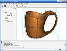
This program lets the users create NURBS surfaces from the OBJ polygon mesh.
It is an AutoCAD plug-in that allows you to import and manage spatial data.
Combines geometries using the spatial methods STDifference, STIntersection, etc.